
 Photo: fuente: COVT · CC BY 3.0
Doñana, Sherry & Atlantic Loop
Cross El Rocío and Doñana’s edge to Sanlúcar, Jerez, Cádiz and Vejer on a five-day coast-and-wetlands circuit.
- Allow
- 5 days
- Route
- 415 km
- Drive time
- 6 hr 34 min
- Stops
- 7
South-west of Seville, the Guadalquivir dissolves into marsh before meeting the Atlantic. El Rocío and Doñana supply wildlife and pilgrimage culture; Sanlúcar and Jerez explain the sherry triangle; Cádiz and Vejer bring sea walls and white-town streets into the same loop.
Doñana access is controlled and sensitive—book official excursions rather than inventing tracks. Bodega days need a designated driver or taxis, and beach traffic makes summer weekends the least flexible time for this otherwise relaxed route.
The road, in one glance
Pinch or scroll with Ctrl / ⌘ to zoom
Drawing the route…
The route earns
its distance
Each pin is selected as a place to do something—not merely proof that you passed through.
- 01Seville
- 02El Rocío
- 03Doñana National Park
- 04Sanlúcar de Barrameda
- 05Jerez de la Frontera
- 06Cádiz
- 07Vejer de la Frontera
 Photo: Ingo Mehling · CC BY-SA 4.0
Seville
Start south-west after city days, with an official Doñana visit already reserved.
Seville is the capital and largest city of the Spanish autonomous community of Andalusia and the province of Seville. It is situated on the lower reaches of the River Guadalquivir, in the southwest of the Iberian Peninsula. Seville has a municipal population of about 686,741 as of 2024, and a metropolitan population of about 1.5 million, making it the largest city in Andalusia and the 5th-largest city in Spain.
 Photo: Benjamin Smith · CC BY-SA 4.0
El Rocío
Sandy streets and a major pilgrimage sanctuary stand at the edge of Doñana’s marsh landscape.
El Rocío is a village in the municipality of Almonte found in southern Spain. It belongs to the province of Huelva, in the autonomous community of Andalusia. El Rocío is situated between the cities of Huelva and Jerez de la Frontera.
 Photo: Wikimedia Commons contributor · CC BY-SA 3.0
Doñana National Park
Wetlands, dunes and seasonal birdlife form one of Europe’s most important protected landscapes.
Doñana National Park or Parque Nacional y Natural de Doñana is a natural reserve in Andalusia, southern Spain, in the provinces of Huelva (most of its territory within the municipality of Almonte), Cádiz and Seville. It covers 543 km2 (209.65 mi2), of which 135 km2 (52.12 mi2) are a protected area. It is named after Doña Ana de Silva y Mendoza, wife of the 7th Duke of Medina Sidonia.
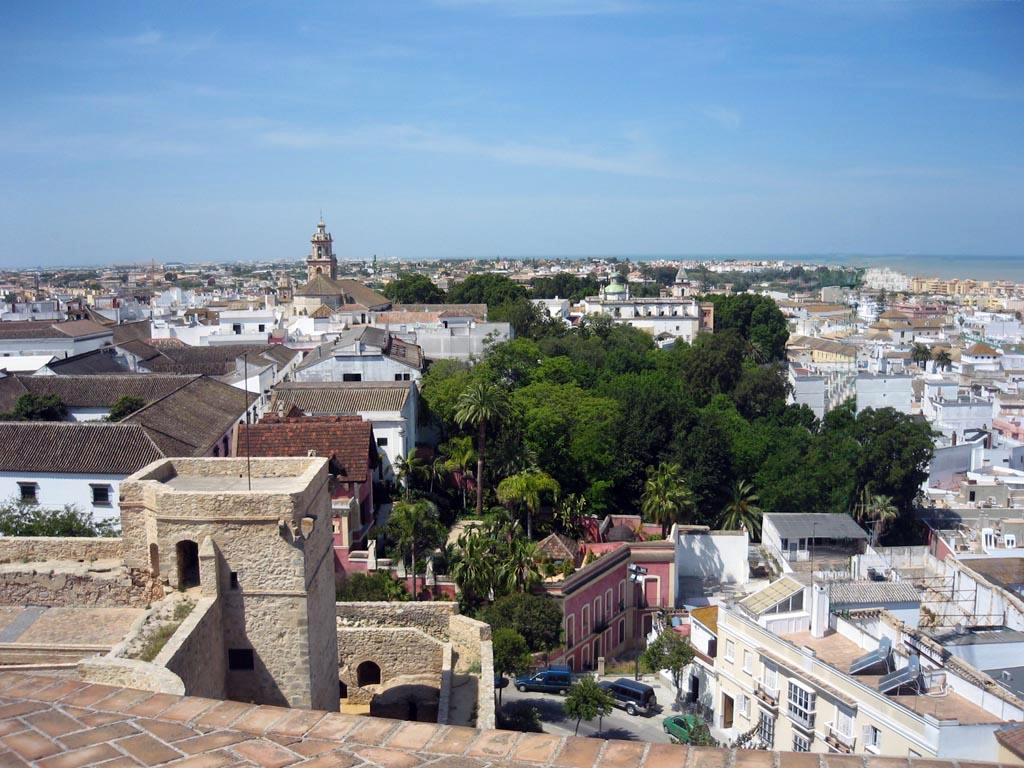 Photo: Antonio M. Romero Dorado , retouched by Fernando Pascullo · CC BY-SA 4.0
Sanlúcar de Barrameda
The Guadalquivir estuary, seafood and manzanilla bodegas make a natural two-night base.
Sanlúcar de Barrameda, or simply Sanlúcar, is a city in the northwest of Cádiz province, part of the autonomous community of Andalucía in southern Spain. Sanlúcar is located on the left bank at the mouth of the Guadalquivir River opposite the Doñana National Park, 52 km from the provincial capital Cádiz and 119 km from Sevilla, capital of the autonomous region Andalucía.
 Photo: Annie and Andrew · CC BY 2.0
Jerez de la Frontera
Cathedral, alcázar, equestrian traditions and sherry cellars make this more than a tasting stop.
Jerez de la Frontera or simply Jerez or Xeres, is a city and municipality in the province of Cádiz in the autonomous community of Andalusia, Spain. Located in southwestern Iberia, it lies on the Campiña de Jerez, an inland lowland plain crossed by the Guadalete River, midway between the Atlantic Ocean, the Guadalquivir river and the western reaches of the Subbaetic System.
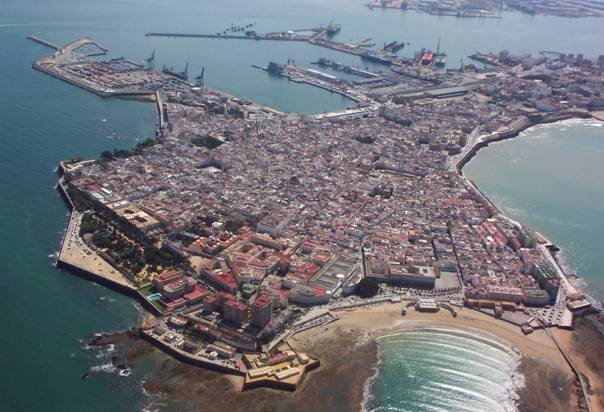
Photo: fuente: COVT · CC BY 3.0Cádiz
An Atlantic peninsula of sea walls, beaches, towers and dense old streets provides the route’s urban high point.
Cádiz ( kə-DIZ, US also KAY-diz, KA(H)D-iz, Spanish: ) is a city in Spain and the capital of the province of Cádiz in the autonomous community of Andalusia. It is located in the southwest of the Iberian Peninsula off the Atlantic Ocean separated from neighbouring San Fernando by a narrow isthmus. One of the oldest continuously inhabited cities in Western Europe, Cádiz was founded by the Phoenicians as a trading post.
 Photo: Diego Delso · CC BY-SA 4.0
Vejer de la Frontera
A white hill town above the coast adds an elevated final night before the drive back to Seville.
Vejer de la Frontera is a Spanish hilltop town and municipality in the province of Cádiz, Andalusia, on the right bank of the river Barbate. The town of Vejer de la Frontera occupies a low hill overlooking the Straits of Gibraltar and surrounded by orchards and orange groves. It contains several ancient churches and convents, and the architecture of many of its houses recalls the period of Moorish rule, which lasted from 711 until the town was captured by Saint Ferdinand of Castile in 1248.
Drive the conditions,
not the itinerary.
Never enter protected Doñana tracks without authorized access. Keep the driver sober on bodega days and allow major summer beach-traffic margins.
Checked against
the people who run it
Distances and driving times are planning estimates. Conditions, closures, ferries, permits and park rules can change, so check the linked official guidance before setting out.